Capturing high-precision data with advanced drone technology and LiDAR systems for urban and industrial development.
Explore More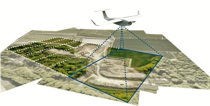
Efor Global provides a wide range of comprehensive drone surveying services in the private and public sectors. As new and refined methods of surveying are gaining momentum, our surveyors are adopting state-of-the-art equipment and innovative technologies. With the dynamic expertise and creative problem-solving of our team, we thrive to provide you with ground-breaking, timely solutions to the age-old challenges of surveying.
Apart from traditional methods, we are conducting digital surveying through mobile applications and utilizing aerial drones for mapping. These help us accumulate a large number of real-time data for our clients making the surveying process extremely precise. Our drone-powered and digitally driven surveying methods have extensively helped clients like government agencies, city planners, architects, and administrators for data collection amongst others. The drones we employ bear high-quality cameras docked with all the current features to capture the minutest of details that are impossible to capture with traditional surveying. Switching to the contemporary methods of surveying has helped us in cost reduction by saving on equipment and labor costs and automating data collection using drones with improved efficiency.
Generating detailed maps showing the natural and man-made features of the land.
High-precision 3D mapping using light detection and ranging technology.
Accurate calculation of stockpiles and excavation volumes for mining and construction.
Initial assessment and planning.
Optimizing drone paths for coverage.
Converting raw data into actionable maps.
Quality checks and delivery.

The approach and methodology that led us to accomplish the project of Property Survey Haryana was a crystal-clear understanding of the requirements, effective planning for in-person field survey using a mobile device, and strategy towards project monitoring.

Behror is gateway of Rajasthan situated on NH-8 at Mile Stone 133/500 and it's connects Jaipur to Delhi. Due to the heavy vehicle movement its cause bottle neck when NH8 passes through the Behror town.
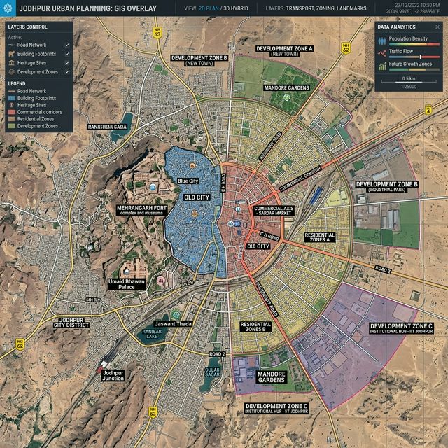
Preparation of City development plan for the following towns and cities of Rajasthan viz. Ajmer, Kishangarh and Kekri cities and Nokha CDP is more focused towards financing and project implementation.